When you have got mush in your head or sick at your heart, then the best therapy is to go on a hike. Journalists of “The Crimean Magazine” have researched the topic and offer to you five touristic routes through natural sightseeing attractions of the Crimean peninsula for self-knowledge and mind reloading.
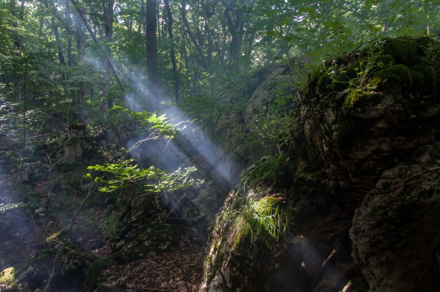
On the way of stone waves of Karabi-Yayla

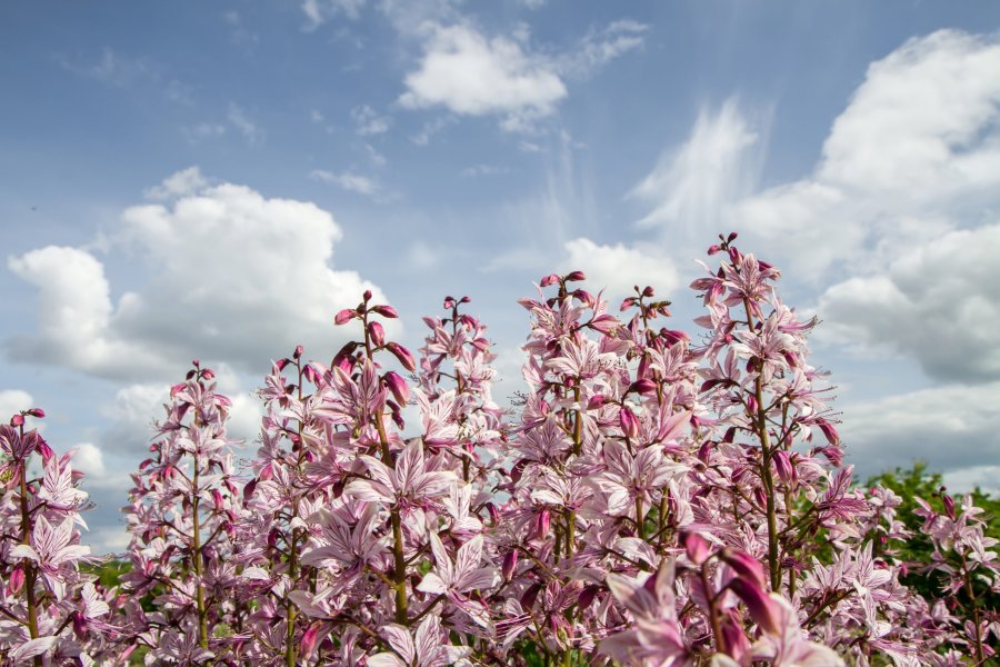
The ancient mountain plateau (Belogorsky district) is isolated from local settlements. Here, you can stay alone together with the ancient nature of Crimea and have a good rest at any season of the year…In spring, on the contrast of grey karst cavities and saturated blue skies it’s so nice to enjoy a blossoming of brightly red and pale pink Crimean peonies listed into the Red Book. In summer, you can breathe the healthful air smelling of thyme and magnolia vine flavors, as well as watch myriads of stars, which race each other to fulfill people’s wishes in warm August nights. The autumn season is a nice period to meditate against the background of panoramic views of hills and mountains overgrown with forests and views of the sea, where the bear of the Ayu-Dag Mountain hung its head into the water.
How can you reach?
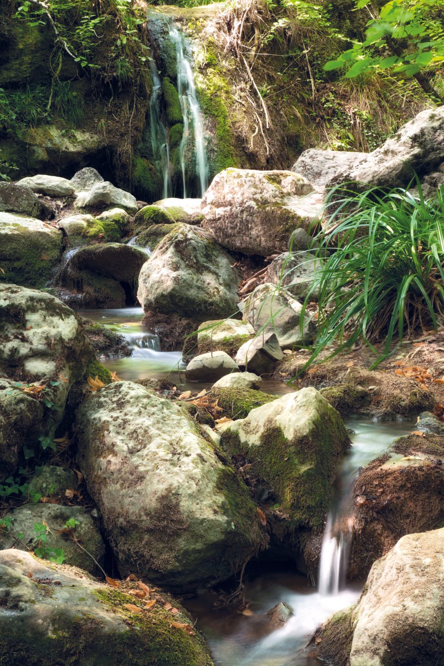
To get to Karabi-Yayla, tourists can go through the General’skoye village (on their way to the mountain sightseeing attraction, tourists are able to visit the Jur-Jur Waterfall) from the settlement Zelenogor’ye or follow the former tourist itinerary № 25 called “Through Soviet guerilla trails of Crimea”. If desired, after a walk in the plateau, a person is able to come down to the sea to the village Rybach’ye.
Fact to know
Karabi-Yayla enjoys a good reputation among speleologists, as the whole plateau is strewn with upstanding caves. There are about several hundred of such caves in that area and the deepest one is Soldatskaya (517 meters).
Lace Bakla: Journey in dreams of Theodoro
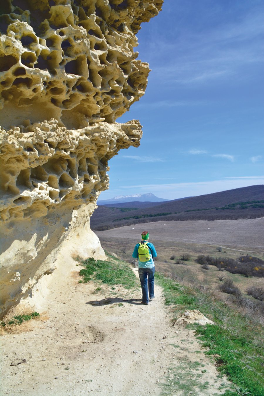
The Bakla Boundary (near the Skalistoye village, Bakhchisaraisky district) is the most northern and the most elegant “aristocratic fragment” of the formerly powerful Principality of Theodoro. Bakla threw a lace shawl knitted during centuries by wind and water over its mountains and dozed off to the whisper of wind flowers. It must be dreaming about times, when from the second half of the III-rd century during ten consecutive centuries the life was full within its houses, streets, fields and vineyards. An appropriate landscape of an inland chain of the Crimean Mountains shields the valley from strong winds. Moreover, an abundance of sun and presence of fertile lands predetermined the major activity of the town and its outskirts’ habitants. Some historians suppose that Bakla was a breadbasket of the principality. Here, everything expresses calmness. It may seem the town fell asleep, but it wasn’t plundered or destroyed. A place’s ambience is especially perfect in inter-season periods. Tourists can walk in a total solitude, sit on “carved” balconies, look into the chambers of the ancient “flat” and search remnants of the earliest marine creatures in limestone areas. In general, guests of this place will be able to imagine how people of the past lived, joyed and felt sad here just eight centuries ago.
How can you reach?
Move from the bus station “Zapadnaya” (Simferopol) to the village Nauchnoye and get off at the bus stop “Skalistoye” (market). Further, go 250 meters on foot to the “Cross”, then turn to the left and walk to the lake with azure water (this is another sightseeing attraction, which appeared because of quarry engineers damaged water-bearing bed and incoming water submerged the excavations). Go around the quarry and follow a pathway to scarp slopes. On your way back, you can choose another route. Come down the road leading to the village Malinovka and reach the Bakhchisarai-Simferopol highway.
Ai-Petri — Balaklava: above Crimea, above the world
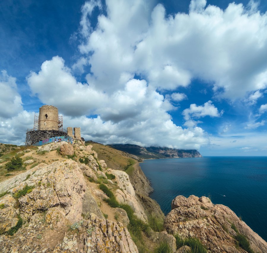
Here, the sky meets the sea and they both become an infinite blueness, light grey upstanding rocks sharply break hundreds of meters downside and time slows down. In the middle of April and beginning of May, as in the Crimean mountain pastures, so peonies, wind and heady sense of freedom rule in the Baidaro-Kastrapol’skaya sublimity too. The last thing of that expression reveals itself in the possibility to prolong a pleasure and reach the final point in Balaklava. On the other hand, visiting Foros is another good opportunity to save the part of that pleasant moment for future. Furthermore, it will be a good reason to return and continue a trip. If your acquaintance with Crimea starts in that hike, then you will carry the love to this region in the rest of your life. From the sublimity, tourists can enjoy a panoramic view of the Southern Coast of Crimea. One section of the tourist itinerary (from the settlement Kastropol) passes through a well-preserved old Roman road, which was built more than 2000 years ago. Onward, wend your way along the Great Sevastopol Trail (find out more details about the tourist route in the issue of “The Crimean Magazine” № 24 — editorial note) near the well-known Death Barrel and less famous Cembalo Genoese Fortress right to Balaklava and the sea.
Note:
Within the area from Ayazma to Balaklava, you can see clusters of highly toxic, but beautiful plants named the Burning Bush growing along the trail.
How can you reach?
An itinerary is estimated as a four-day hike (about 60 kilometers). The first day: an aerial lift to Ai-Petri — Besh-Tekne Boundary (overnight stop). The second day: Besh-Tekne Boundary -Baidarskiye Gates Pass (here, you can finish your hike and come down to Foros or spend a night and continue travelling). The third day: Baidarskiye Gates — Tushlar Boundary — “Temple of the Sun” — Laspi Pass — Inzhir Boundary (Ayazma) (overnight stop). The fourth day: Inzhir Boundary (Ayazma) — Balaklava.
Dzhurla-Alaka-Satera: password “Figure Eight”
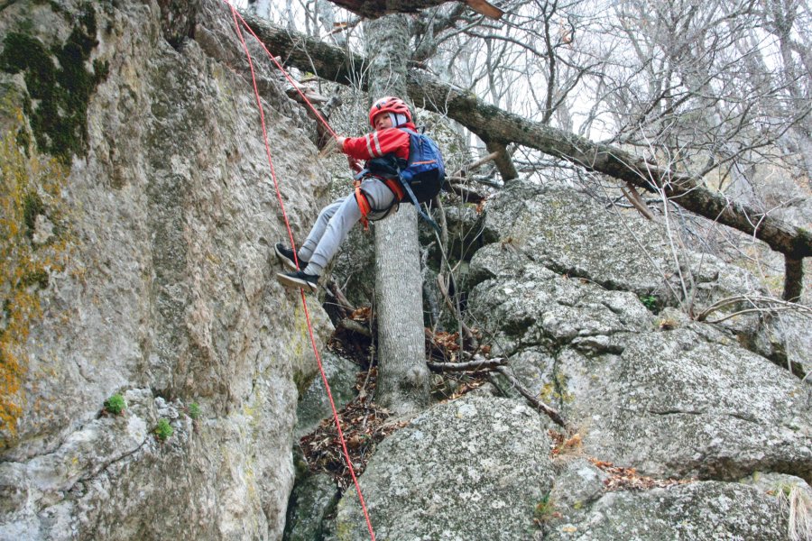
Not so many people know that Crimea is a nice place for engaging in canyoning (climbing down waterfalls’ cascades — editorial note). Such an extreme entertainment gains swiftly. In the area of the Demerdzhi Mountain (village Luchistoye) at the Dzhurla River, thrill seekers are able to climb down the sheer walls and waterfalls of the Alaka Boundary. This adventure can be easily combined with a hike, but potential tourists will need special mountaineering equipment and required skills at any rate. Adherents of extreme recreation activities will have to overcome from six to nine cascades (some of the obstacles can be rounded through the trail) with a height up to 20 meters. Canyoning arrangements will take the whole day. As a bonus, besides of a perfect training and unforgettable ultimate experience, canyoning fans will get “songs” of a cut-glass mountain river and no less than ten picturesque waterfalls.
Note:
Canyoning is a kind of an extreme entertainment. If you are a beginner and resort to services of an instructor, then we advise you to make sure he or she has got an appropriate climbing qualification (training coordinator, trainer or master of sports) or a qualification in mountain rescue operations (certified rescuer), as well as high quality equipment. Your life and health will depend on that equipment.
How can you reach?
The first variant (route of 25 kilometers): Angarskyi Pass — Northern Demerdzhi — “Demerdzhi” tourist post — Dzhurla Waterfall — Alaka River (If you wish, you can reach the Satera Boundary and come down to the sea). The second option (itinerary of 19 kilometers): bus stop Luchistoye (Alushta) — walk along an asphalt road to the settlement Luchistoye — Koroviya Trail — Dzhurla Waterfall — Alaka River.
Through guerilla trails
In the years of the Great Patriotic War, Crimea was a region, where fierce battles and active guerilla movements took place. Seventy five years have passed since then. The formerly popular walking route № 25 “Through Soviet guerilla trails of Crimea” is undeservingly forgotten now. “The Crimean Magazine” suggests our readers to pass those trails again (exactly go on foot, but do it pensively and attentively) and imagine how Soviet partisans of the Zuisky Squad of the Eastern Fighting Formation were combating here in the 1942-1944 time period. You will be able to see in details positions of the squad’s home station, filed hospitals, three-inch filed guns and an air station. You can spend a day or even two on this hike.
How can you reach?
There are variants of climbing up in the village Pereval’noye. The first one is Chelbash or Malinoviy River — Monument to Klava Yuryeva — Small Burulcha — Big Burulcha — tourist post “Partizanskaya” — Yuka-Tepe height (1025 meters). The second option can be called a radial trip: Mokrousov Rocks — guerilla air station (Orta-Syrt) — guerilla air station at Karabi. If you wish you can attend the Mound of Glory.