


Афиша
Местное время
Звёздный городок
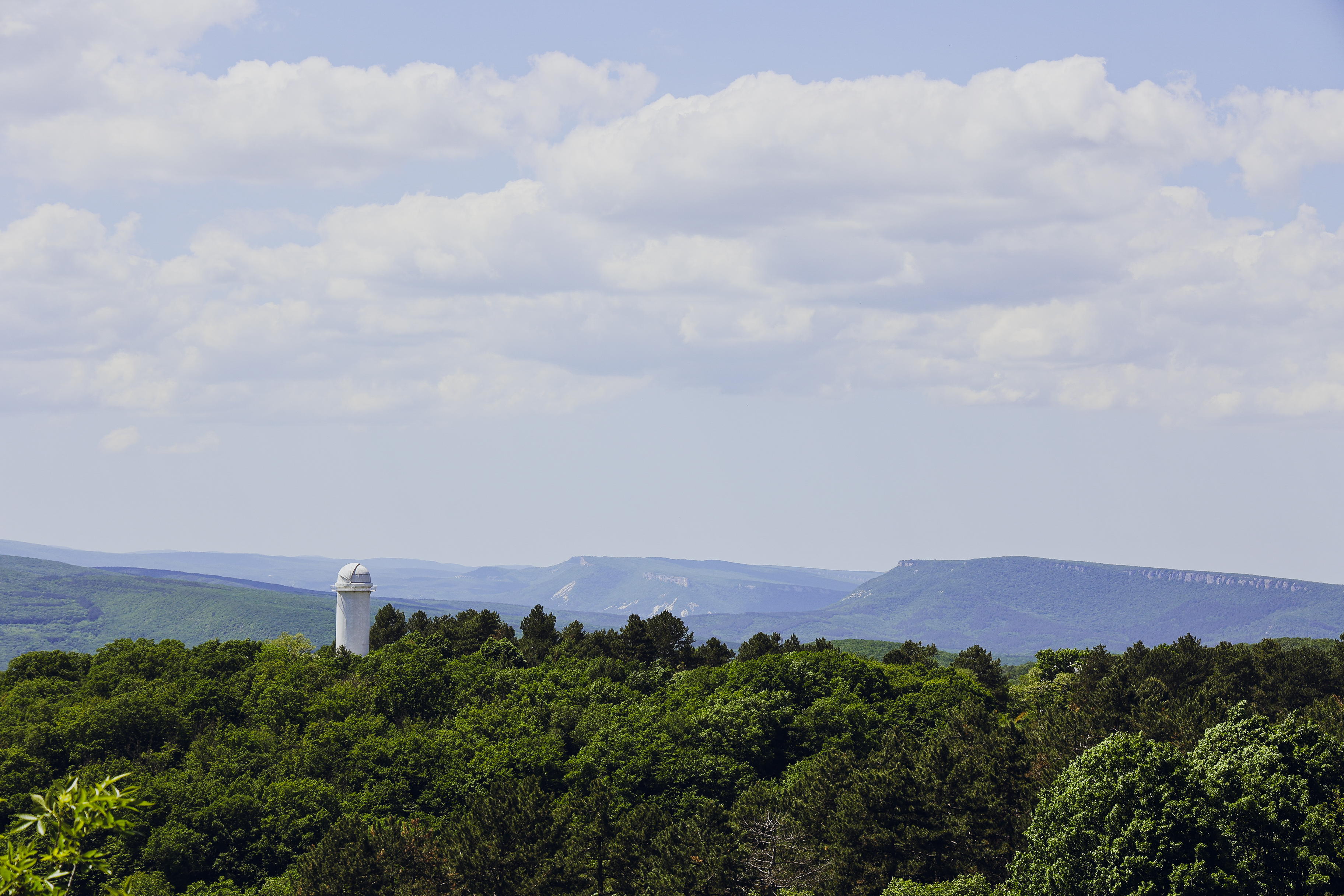
Посёлок Научный в Крыму – уникальное место с особой атмосферой. Расположенный в Бахчисарайском районе, он известен благодаря Крымской астрофизической обсерватории. Посёлок был основан в середине XX века как жилой городок для учёных-астрономов. Главная достопримечательность – телескопы обсерватории, в частности, знаменитый зеркальный телескоп имени академика Шайна. Научный привлекает туристов атмосферой уединённости и красивыми пейзажами. А ночное небо над посёлком особенно прекрасно – вдали от городской засветки звёзды светят ярко, словно приглашая к новым открытиям. Фото: Михаил Гладчук